


Tardevant

DUCLUZEAU
User
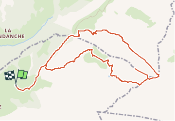

Length
13.1 km

Max alt
2480 m

Uphill gradient
1106 m
Km-Effort
28 km

Min alt
1441 m

Downhill gradient
1104 m
Boucle
Yes
Creation date :
2025-06-05 20:33:14.937
Updated on :
2025-06-05 20:33:16.852
6h19
Difficulty : Very difficult

FREE GPS app for hiking
 SityTrail
IGN / Geographical institutes
SityTrail Plus
The world is yours!
About
Trail Walking of 13.1 km to be discovered at Auvergne-Rhône-Alpes, Upper Savoy, La Clusaz. This trail is proposed by DUCLUZEAU.
Positioning
Country:
France
Region :
Auvergne-Rhône-Alpes
Department/Province :
Upper Savoy
Municipality :
La Clusaz
Location:
Unknown
Start:(Dec)
Start:(UTM)
304908 ; 5088517 (32T) N.
Comments